If you are a regular reader of my blog, you may remember my last post, in which I mused about which of several settings I should choose for the next book. Perhaps subconsciously influenced by this year’s RITA historical finalists–many of which seem to have involved dukes and Scotland–I did opt to send my duke to the Isle of Skye. In case you were wondering, it’s off the northwest coast of Scotland, very far away from the ballrooms of London:
One of the things I like best about setting my books in the Victorian era is that it is very easy to get my characters from one place to another, compared to the Regency period. Trains criss-crossed the country, allowing people to move with relative ease from London to Glasgow, Perth to Cornwall.
Unfortunately, trains did not get anywhere near Skye until 1897, so the other day I spent hours trying to figure out how my intrepid hero–a city boy who hates to travel–would journey from southern Scotland to Skye. The almighty Google revealed two guidebooks: Black’s Picturesque Tourist of Scotland, Ninth Edition (1851), and Anderson’s Guide to the Highlands and Islands of Scotland (1850).
Although it was possible to take a steamer from Glasgow directly to Skye (a fact I discovered only after a day spent mapping the picturesque route, naturally), the guidebooks recommended the following route to Skye (in the summer, of course) for those who wanted to take in the scenery:
![Patrick Mackie [CC BY-SA 2.0 (http://creativecommons.org/licenses/by-sa/2.0)], via Wikimedia Commons]( https://upload.wikimedia.org/wikipedia/commons/3/30/View_of_Loch_Lomond_-_geograph.org.uk_-_107928.jpg)
![Stemonitis at the English language Wikipedia [GFDL (http://www.gnu.org/copyleft/fdl.html) or CC-BY-SA-3.0 (http://creativecommons.org/licenses/by-sa/3.0/)], via Wikimedia Commons](https://upload.wikimedia.org/wikipedia/commons/b/bb/Ben_Arthur.jpg)
Day 2: Being a sensible sort, our hero will ask the innkeeper to pack a nice lunch for him (unlike when my friend Helen and I set off up a mountain in Keswick, England last fall, because we were so sure we’d be done well before lunch–we weren’t). He’ll then hike around the base of The Cobbler to Cairndow on Loch Fyne, a distance of 12 miles. From there, he could hop on a ferry across the loch to Inveraray (6-1/2 miles), or walk around the head of the loch (9 miles).

Our hero will spend the night at an inn in the shadow of Inveraray Castle, the seat of the Duke of Argyle. (Of the castle, Black’s guidebook notes, “in one of the rooms is some very beautiful tapestry, which the old lady who exhibits it, states to have been ‘made by the goblins, wha’ are a’ dead now.'”) On Day 3, our hero will continue his journey overland, perhaps carrying two meals this time and a couple of snacks, for this part of the journey begins with a 9 mile hike across rugged terrain to Cladich on Loch Awe.
![Chris Heaton [CC BY-SA 2.0 (http://creativecommons.org/licenses/by-sa/2.0)], via Wikimedia Commons](https://upload.wikimedia.org/wikipedia/commons/3/35/Loch_Awe.jpg)
If he is anything like me and Helen, he’ll get lost and it will take six hours rather than three, so he’ll spend the night there. If not, he’ll walk for two hours or so along the banks of the loch to Dalmally and stay there instead.
On Day 4 (or 5), he’ll set out from Dalmally on the hardest part of the journey, a 24-mile walk to Oban. Being a pathetic city-dweller, I wouldn’t be surprised if he’d have to stop somewhere along the way–fortunately there is an inn about halfway across in Taynuilt. It sits not far from the base of Ben Cruachan, the highest point in the County of Argyll.

From Oban on Day 6, 7, or possibly 8 (I admit I’ve lost track at this point), he’ll buy some fabulous Oban whisky and then board a steamer which will make its way up the coast, a trip that will take one or two days (possibly three, as getting through Kyle Rhea requires high tide) to Broadford on the Isle of Skye.
![cisko66 [CC BY 3.0 (http://creativecommons.org/licenses/by/3.0)], via Wikimedia Commons](https://upload.wikimedia.org/wikipedia/commons/e/ed/Broadford%2C_Isle_of_Skye_IV49%2C_UK_-_panoramio.jpg)
Nowadays, of course, you can travel by train nearly the entire way, then cross a bridge or hop on a ferry over the sea to Skye. I just might be inclined, however, to try to retrace the journey undertaken by thousands of adventurous Victorian tourists on my next trip across the Pond. Perhaps Helen would come with me, if I remember to bring snacks. And a good map. 🙂
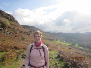
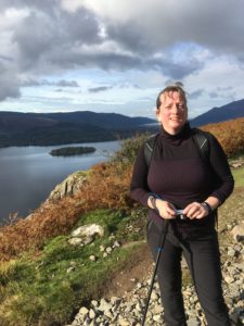
Since I have mentioned my hike with Helen, I thought I’d share a couple of photos. I look far more exhausted, but in my defense I should like to point out that my picture was taken just after we hauled our middle-aged butts to the top of Walla Crag, while Helen’s was ever so kindly taken as we made our way down the other side.


![Contains Ordnance Survey data © Crown copyright and database right [CC BY-SA 3.0 (http://creativecommons.org/licenses/by-sa/3.0)], via Wikimedia Commons](https://upload.wikimedia.org/wikipedia/commons/7/70/Isle_of_Skye_UK_relief_location_map_labels.jpg)